Nobo-Touls
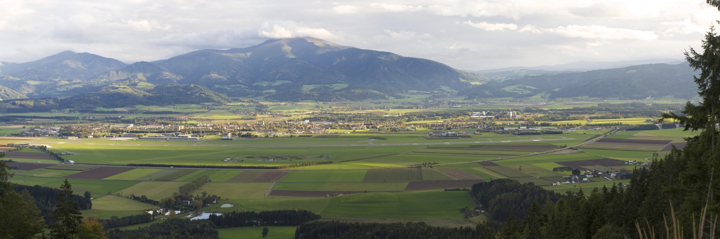
Aichfeld with Zeltweg-Airport (LOXZ) from north to south (https://de.wikipedia.org/wiki/Zeltweg)
For downloading the source code of the package nobotouls see here: Download and Installation.
What is it for?
NoboTouls supplies a suite of python tools to manage, modify and plot HOBO station data (measured and data logged with products of the US-company http://www.onsetcomp.com/) for the Aichfeld-Project. To avoid copyright violations the name of this program suite was changed from HOBO-Tools to Nobo-Touls and because of simplicity (find & replace reasons) HOBO-files are from now on called NOBO-files.
Not all of the functionality here is provided by the much more comfortablly to use free *Onset*(TM)-Program HOBOware
Use is made of following python libraries:
- http://www.numpy.org/
- http://matplotlib.org/
- http://matplotlib.org/basemap
- http://gdal.org/python/
- http://www.scipy.org/
New
Nov 12, 2016: NoboTouls Version 0.0.5: in nobowindmap and in nobowindmap2 low winds below 2.5 knots are shown with an emtpy wind arrow as direction indicator. Only very low winds below 0.1 knots are shown as directionless small circels/dots. - The changes were applied in module inout.py to function/procedure plot_wind.
Sept 18, 2016: NoboTouls Version 0.0.4 with bug fixes concerning nobowindmap.py for for Debian Jessie and OS-X for dealing with lat, lon - values in map plotting routines
For those who do not want a complete reeinstall change in module noboinout.py in function def plot_windmap (about line 1406 of module):
false:
"""Plot a single wind barb with u,v in map 'bmap' at lat, lon"""
...
x, y = bmap(lon, lat)
...
correct:
"""Plot a single wind barb with u,v in map 'bmap' at lat, lon"""
...
x, y = bmap(float(lon), float(lat))
...
Contents
- 1. Programs
- 2. Modules
- 3. Input parameter files, databases and input files
- 4. Download and Installation
- 5. Changelog
- 6. License - Lizenz
- 7. Impressum und Haftungsausschluss - Imprint and Disclaimer
- 8. Erklärung zur Informationspflicht (Datenschutzerklärung)